

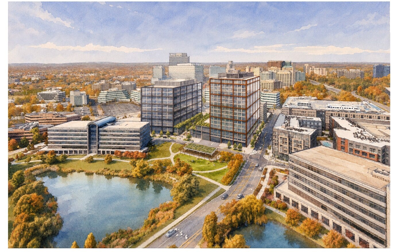
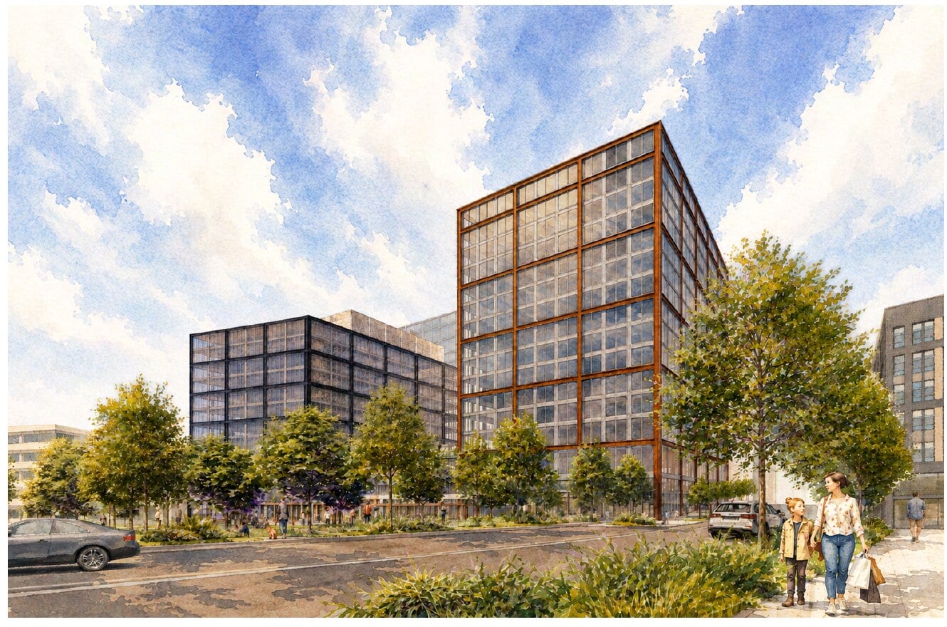
On July 31, Halley Rise Holdings filed amended plans with Fairfax County to redraw the four blocks of its Reston project that nobody has built yet.
The project does not get bigger. Every square foot the county approved back in 2018 stays approved. The developer wants to move those square feet around, and the moves are substantial. Office space slides south. Housing shifts toward the Metro. Crescent Park gets a redesign and a new name. And the block closest to the train loses its loading docks in favor of a plaza.
Halley Rise Holdings bought this portion of the project in July 2025, according to the application. The land sits in the Reston Town Center Station Transit-Oriented Development district, just south of the Reston Town Center Metro station on the Silver Line. Today it holds an above-grade parking deck and two surface lots.
What the application does
The filing combines three requests under case number 2016-HM-007. A Proffer Condition Amendment adjusts the binding commitments the developer made to the county. A Conceptual Development Plan Amendment changes the master plan for the whole site. A Final Development Plan Amendment covers the detailed design of the buildings ready to move forward now.
Cooley LLP is running the zoning work. MV+A Architects continues as master plan architect. Morris Adjmi Architects, a New York firm, designed Blocks D and E. LandDesign handled the landscape architecture, Urban Ltd. the civil engineering, and Gorove/Slade the traffic study.
What stays the same
Fairfax County approved 4,161,940 square feet at Halley Rise at a floor area ratio of 2.62. This filing keeps that number exactly. The mix holds too:
- Residential: 1,771,000 square feet, up to 1,721 units
- Office: 1,885,940 square feet
- Retail, commercial, and grocery: 380,000 square feet
- Hotel: 125,000 square feet, up to 200 keys
Heights hold as well. Block H can still rise to 425 feet plus a rooftop penthouse. Block G still caps at 340 feet. The Board of Supervisors approved both numbers in 2018 and this application carries them forward untouched.
Nobody is asking for more here. The request rearranges what the county already granted.
Office and housing trade places
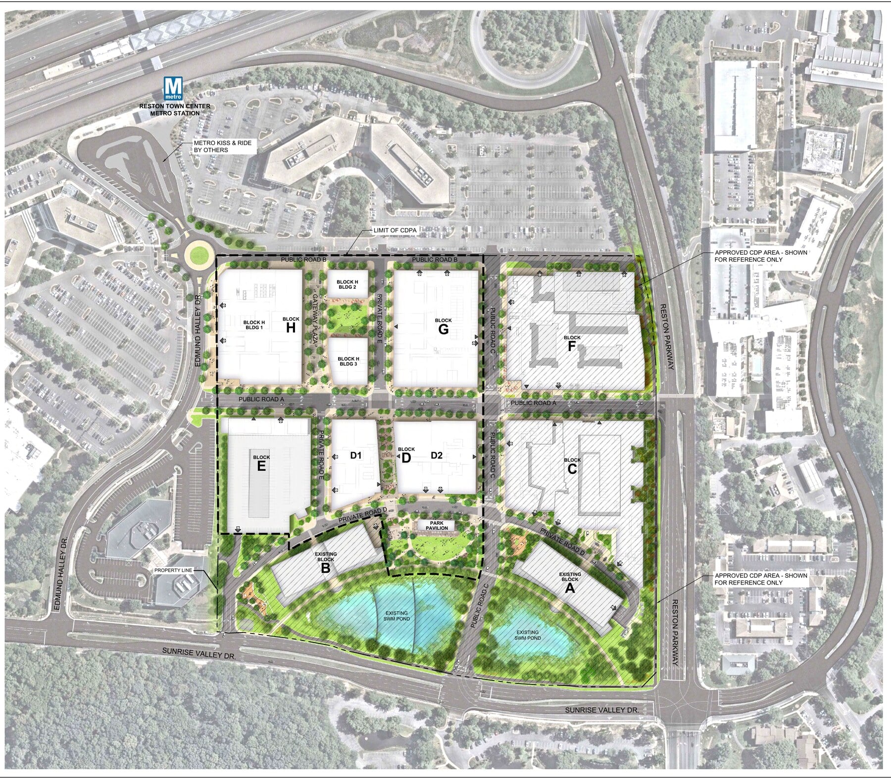
The filing swaps Block D and Block G. Office that the county approved for Block G, up near the station, moves south to Block D. The residential planned for Block D moves north to Block G.
After the swap, the blocks look like this:
| Block | Residential | Retail | Hotel | Office | Total |
|---|---|---|---|---|---|
| A (existing) | 193,428 sf | 193,428 sf | |||
| B (existing) | 192,512 sf | 192,512 sf | |||
| C (built) | 550,000 sf / 500 units | 15,000 sf | 565,000 sf | ||
| D | 75,000 sf | 700,000 sf | 775,000 sf | ||
| E | 23,200 sf | 23,200 sf | |||
| F (built) | 380,000 sf / 380 units | 120,000 sf | 500,000 sf | ||
| G | 450,000 sf / 450 units | 38,400 sf | 125,000 sf / 200 keys | 613,400 sf | |
| H | 391,000 sf / 391 units | 108,400 sf | 800,000 sf | 1,299,400 sf |
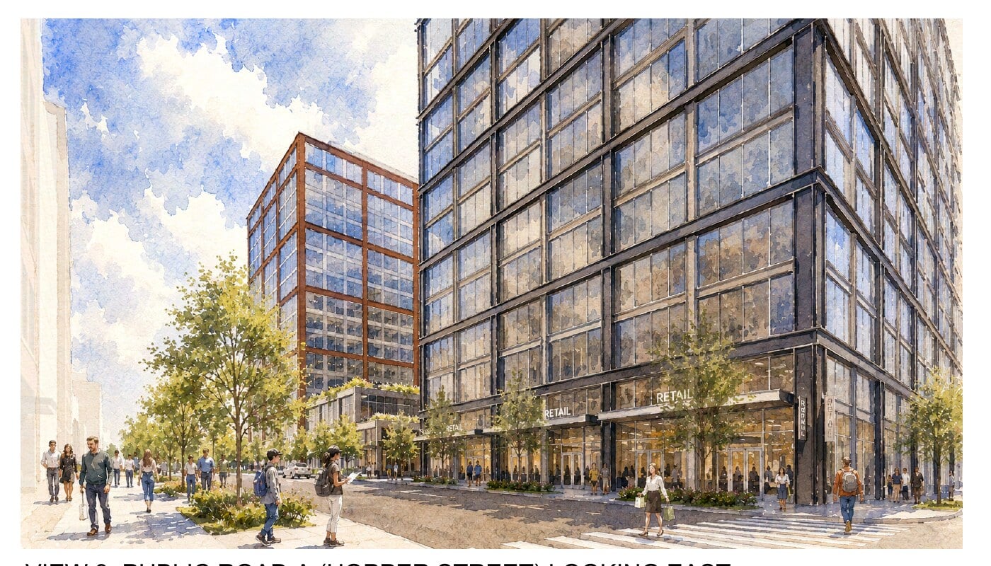
The developer argues for clustering. Blocks A and B already hold office buildings on the south side of the property. Dropping 700,000 square feet of new office onto Block D creates three office blocks in a row, with Hopper Street running between them as a retail main street. The housing then concentrates on Blocks G and H, the two blocks closest to the train platform.
Fairfax County has made that same argument in its own planning documents for the station areas, so the reasoning will sound familiar to anyone who sat through the 2018 hearings. How persuasive it lands in 2026, with office demand where it is, will be the interesting part of staff review.
Block D and E Go First
Block D and Block E are the only pieces of this filing with a final development plan attached. Blocks G and H remain conceptual and will each come back to the county later with their own detailed plans.
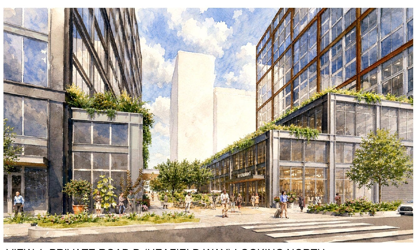
Morris Adjmi designed two office buildings on Block D, labeled D1 and D2, sharing a 1,504-space garage across six levels. All six levels sit below grade. In a suburban office context the default answer is a concrete deck wrapped in decorative panels. Burying the whole thing frees the street for retail and lobbies, and it costs a great deal more to build.
The buildings reach 250 feet, roughly fifteen stories, with retail and a mezzanine at the base. The filing describes the design intent as simple, solid, and elegant, with enough articulation to hold up at eye level along the retail edges. The renderings back that up. These read warmer and more textured than the glass boxes that fill most of the Dulles corridor.
Block E next door is the outlier. It functions as a standalone parking structure with 23,200 square feet of retail and a proposed height of just 70 feet. The elevations show a screened facade and heavy landscaping, which is how the architects answer the problem of putting a garage on a walkable street.
Crescent Park becomes Heafield Green
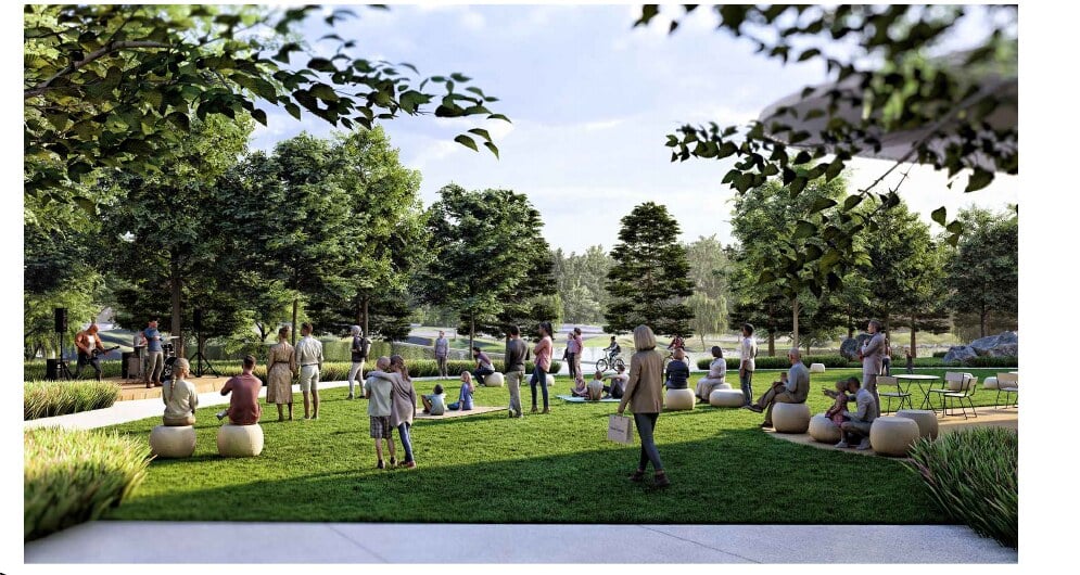
If you followed the earlier Halley Rise plans, you knew the main park as Crescent Park. That name retires. LandDesign redesigned the space and renamed it Heafield Green, and it becomes the neighborhood’s primary gathering place.
A multipurpose lawn anchors the design. Around it the plans place a performance stage, a shade structure, a nature play area built into the landscape instead of dropped onto a rubber pad, and movable seating throughout. The designers repositioned the park pavilion so it screens the garage entrance across Heafield Way while activating the lawn edge at the same time. The pavilion serves food and beverage and caps at 35 feet.

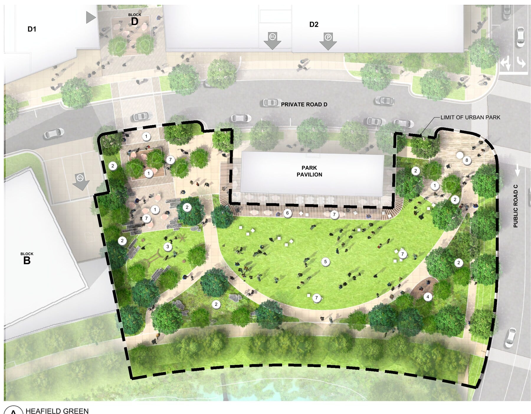
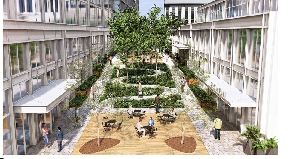
The Mews connects to it. This north-south pedestrian passage currently runs through the middle of Block D. The new plan shifts it to the west side of the block, which straightens the walk from the Metro station down to Heafield Green and the ponds. A raised-table crossing where the two spaces meet slows cars and lets the park and the passage read as one space instead of two.
Block H becomes the front door
The block nearest the station changes the most.
The park that Block G was going to get moves here and becomes the Neighborhood Park, a lawn framed by trees, movable seating, and space reserved for art. Riders coming off the escalator hit a park instead of a garage ramp.
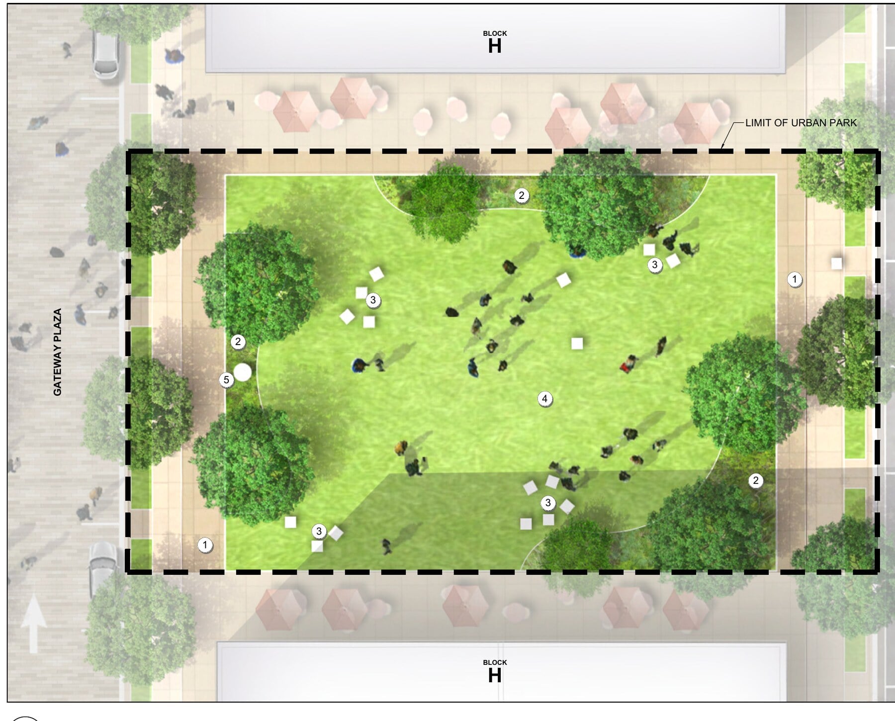
An internal shared street called Gateway Plaza then splits the block. The developer designed it to host markets, street festivals, and other public events, and reserved the option to open it to limited northbound car traffic. Ground-floor retail wraps both the park and the plaza.
The developer also moved every loading dock and garage entrance off Public Road B, the street facing the Reston Crossing property to the north. That side of the block used to be back-of-house. Nobody will photograph the change, but anyone walking that stretch will feel it.
The park math runs tight
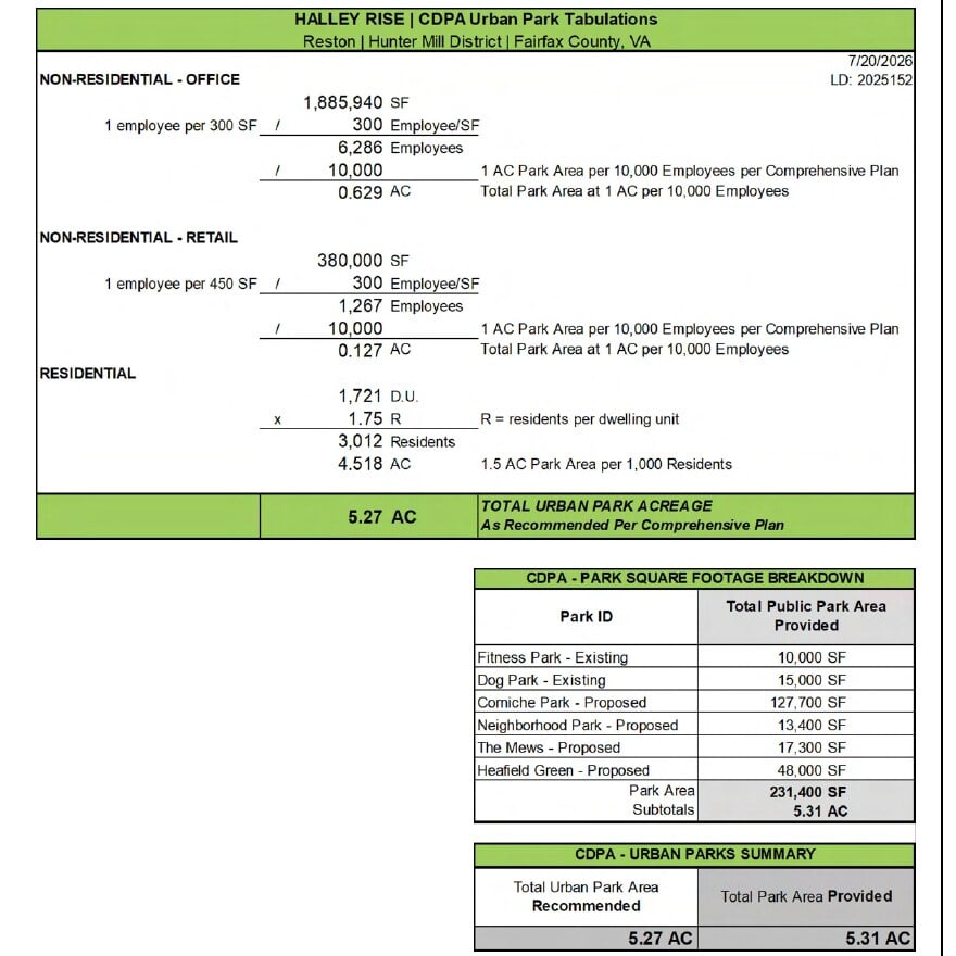
Public park space at buildout breaks down like this:
- Corniche Park (proposed): 127,700 square feet
- Heafield Green (proposed): 48,000 square feet
- The Mews (proposed): 17,300 square feet
- Dog park (existing): 15,000 square feet
- Neighborhood Park (proposed): 13,400 square feet
- Fitness park (existing): 10,000 square feet
That comes to 231,400 square feet, or 5.31 acres. The Comprehensive Plan formula recommends 5.27 acres for a project this size. The developer clears the bar by four one-hundredths of an acre, about the footprint of a two-car garage.
The filing separately counts 8.2 acres of publicly accessible open space, which works out to 30 percent of the net lot area against a 20 percent goal.
The same formula produces the county’s headcount estimate. Run the standard ratios and Halley Rise eventually holds about 6,286 office workers, 1,267 retail workers, and roughly 3,012 residents. Those are planning multipliers rather than forecasts, but they set the scale. A small town lands in a few square blocks off the Silver Line.
Reston Crossing shapes every decision here
The filing mentions the property to the north constantly. Reston Crossing wraps the Metro station’s kiss-and-ride at the end of Edmund Halley Drive.
Bethesda-based Bernstein Management Corporation bought the Reston Crossing office buildings in December 2024, added the adjacent Summit offices in April 2025, and filed its own rezoning application in March 2026 covering roughly 3.1 million square feet across about 23.8 acres. That plan includes around 1,620 residential units, 1.48 million square feet of office, ground-floor retail, and nearly 4.75 acres of public parks.
Two owners are now redrawing everything between the Metro station and Sunrise Valley Drive at the same time. Halley Rise says outright that it redesigned Block H in response to the new Reston Crossing plans, aiming to make the walk from the platform through one project and into the other feel like one place rather than two developments sharing a property line.
Neither application has been approved. Both are still moving through the county.
What stands there today
Two residential buildings are open and leasing. The Edmund occupies Block F and The Arbor occupies Block C, along with the street grid that ties them together. The ground-floor retail runs, anchored by the urban-format Wegmans that opened with the project, plus Panera Bread and a Chase branch.
Everything else in this filing exists only on paper.
What this changes for people who live here
If you own nearby. Finished development around a Metro station generally supports values better than surface parking does, and a working retail street helps more than a fenced construction site. Timing is the catch. Only Block D holds detailed plans right now, and Blocks G and H each need their own final development plan before anyone pours concrete. Plan on years, not seasons.
If you rent or are shopping for a condo in the area. The approvals cover 1,721 units across the whole project, and 841 of those still sit on Blocks G and H. That much new supply arriving in one spot tends to hold rent growth in check locally while making the neighborhood more desirable overall. Both effects run at once.
If you ride the Silver Line. The loading dock relocation and Gateway Plaza both target the walk between the station and everything else. This filing largely concerns your first three minutes after you come down the escalator.
If you drive here. The application also asks the county to vacate a parking reduction approved in December 2020, since Fairfax County has rewritten its parking rules in Article 6 of the Zoning Ordinance since then. The parking math for the site gets recalculated under the newer standards.
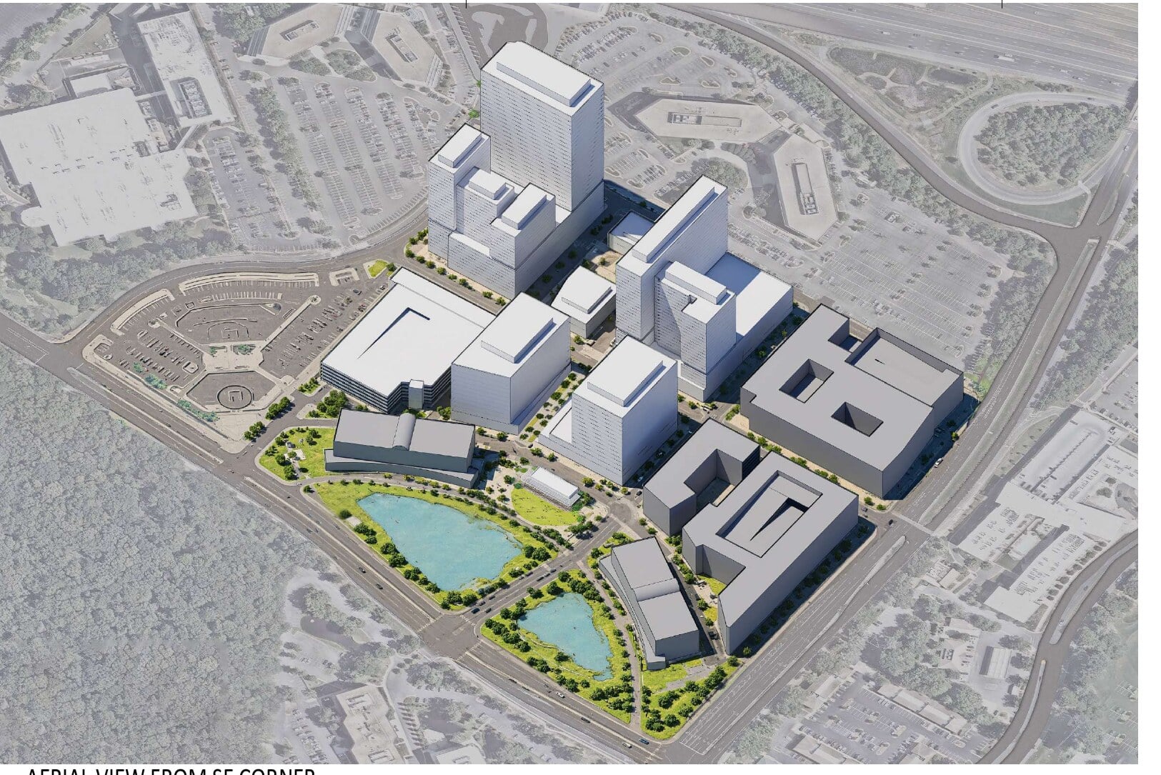
If you care about the trees and the ponds. Both stormwater ponds along Sunrise Valley Drive stay. Corniche Park, at 127,700 square feet, remains the largest single park in the plan and runs along that southern edge. The planting schedule calls for willow oak, London plane, river birch, katsura, redbud, serviceberry, and dogwood, with structural soil cells under the sidewalks so street trees get real root volume. Streetscapes that skip that step look fine at year one and thin out by year fifteen.
What happens next
County staff review the application first. It then goes to the Planning Commission for a public hearing and a recommendation, and finally to the Board of Supervisors for a vote. The site sits in the Hunter Mill District, so watch that supervisor’s office for community meeting announcements.
Expect a Board decision sometime in 2027, and expect the plans to shift along the way. Staff review almost always produces revisions, and Reston rarely stays quiet through a hearing process.
Four things to track:
- Whether the office swap survives review, given how much office both this project and Reston Crossing already carry
- Whether the park acreage holds at 5.31 against the 5.27 recommendation, since the cushion barely exists
- What the amended proffers commit to on workforce housing, public art, school contributions, and construction phasing, since those live in a separate document
- How closely Block H ends up coordinating with whatever the county approves next door
Where this leaves things
Halley Rise is not growing. It is getting rearranged, with office pushed south, housing pulled toward the train, and the parks reorganized into a connected north-south spine running from the Metro station down to the ponds. Block D carries real drawings. Blocks G and H carry ideas.
The last undeveloped corner of the Reston Town Center station area finally has a full plan attached to it, and the property next door is drawing its plan at the same time. What the Board approves over the next eighteen months sets how that district works for the next thirty years.
If you want to talk through what any of this means for a specific home or a specific decision in this part of Reston, reach out anytime. We track these filings closely.