
Association Drive is the quiet loop north of Sunrise Valley Drive where national associations built their headquarters in the 1970s. Low brick and concrete buildings, surface parking, and some of the largest trees left in this part of Reston. Fairfax County has planned that street for redevelopment for years. On Monday, August 31, a builder finally filed to do it.
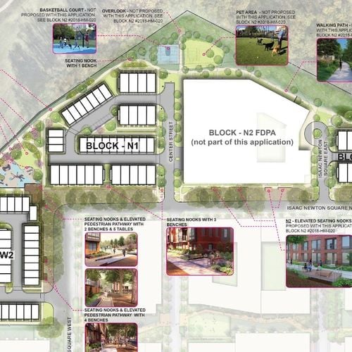
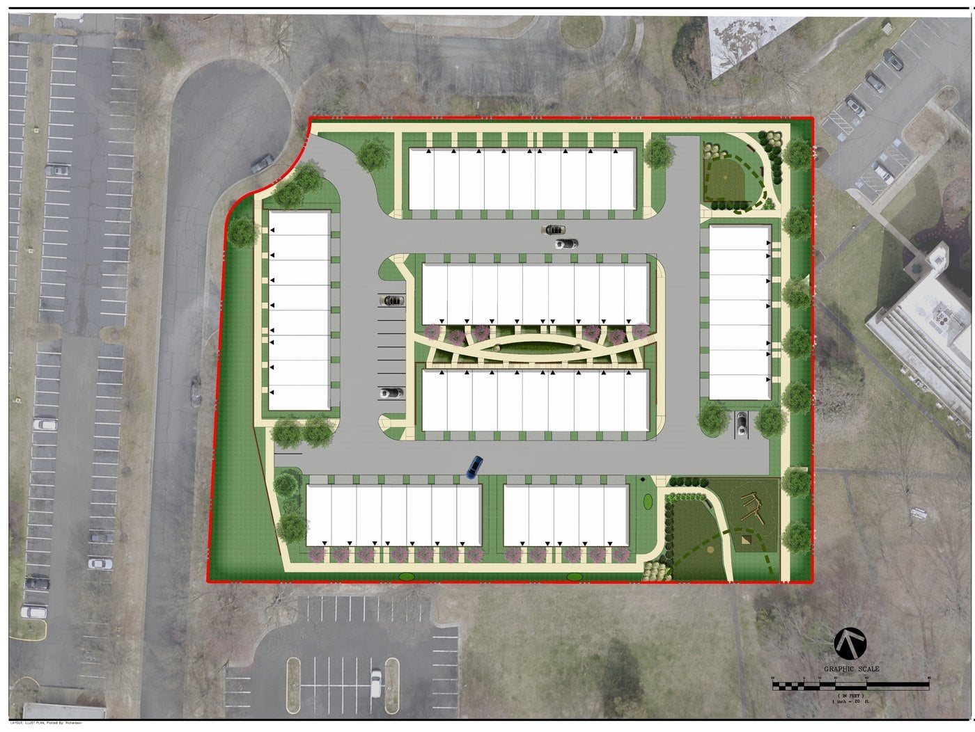
Toll Brothers, through its subsidiary Toll Mid-Atlantic LP Company, Inc., submitted a rezoning application for 1902 Association Drive. The county logged it as RZ-2026-HM-00029. The application would take a 2.54-acre parcel holding a 17,688-square-foot office building and replace it with up to 54 rear-loaded townhouses, two urban parks, and a private alley network. Toll is the contract purchaser, not the owner, so the sale closes only if the rezoning works.
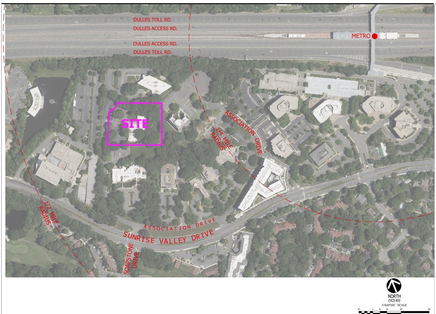
That is a small project by Reston standards. Its position matters more than its size. The parcel sits on the future Soapstone Connector alignment, inside a county plan amendment covering the whole street, and about a third of a mile west of the Wiehle-Reston East Metro station.
What Toll Brothers filed
The application asks Fairfax County to rezone the property from I-3, the light industrial district that covers every parcel on Association Drive, to PDH-20, Planned Development Housing at 20 dwelling units per acre. Toll filed a conceptual development plan and a final development plan alongside the rezoning. The Board of Supervisors acts on the rezoning and the conceptual plan. The Planning Commission acts on the final plan.
The numbers, from the plan set and the statement of justification:
- Up to 54 single-family attached dwellings, all rear loaded, served by private alleys
- Units generally 16 feet wide, up to four stories, with a maximum height of 55 feet
- Density of 21.3 units per acre, above the district’s base of 20, using the affordable housing bonus in Article 5 of the zoning ordinance
- 88 parking spaces required, up to 119 provided, plus 18 bicycle spaces
- Two urban parks totaling 10,890 square feet, or a quarter acre, against a requirement of 0.23 acre. Urban Park A includes a natural playground
- Three waivers and modifications: private streets narrower than 24 feet, townhouses as the primary use, and a reduced landscape amenity panel in places
VIKA Virginia drew the plans and the landscape design, Galloway and Company is the transportation engineer, and Brian Winterhalter of DLA Piper is the land use attorney. The same VIKA and DLA Piper pairing is behind Maker’s Point a mile west on Sunrise Valley Drive.
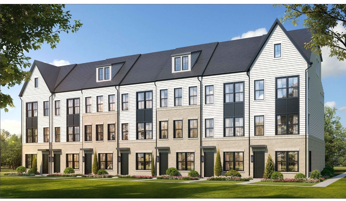
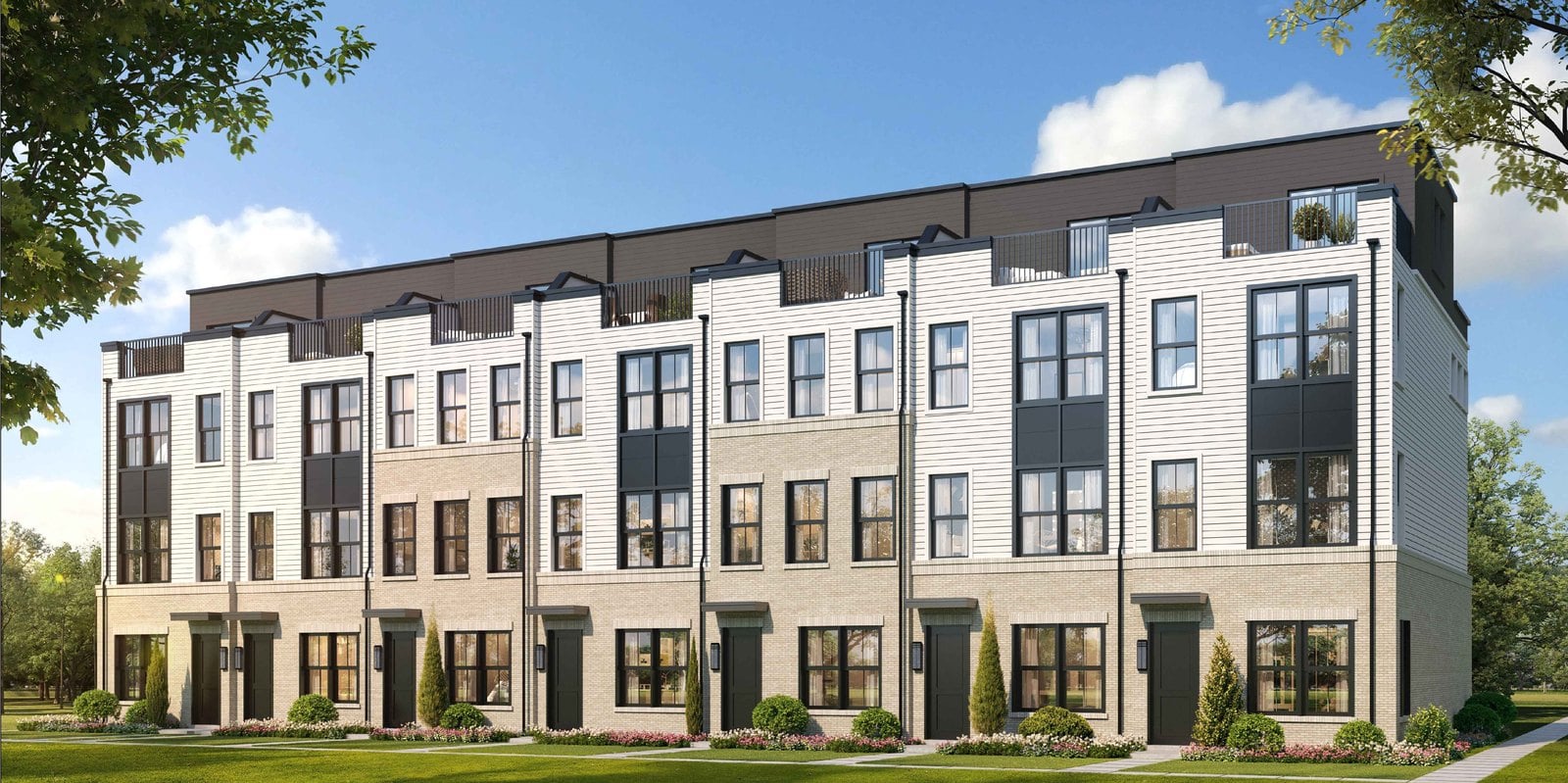
Two illustrative perspectives appear in the plan set, one with a flat roof and rooftop terraces and one with gables and dormers. Both carry the note “shown for illustrative purposes only,” so read them as a design direction rather than a promise.
One affordable unit, five workforce units
Sheet C-02 carries the affordable housing math, under a heading that reads “Rosenthal/ Association Drive ADU/WDU Calculations.” The formula produces a 2.5 percent affordable dwelling unit requirement, which works out to one ADU across 54 townhouses, plus five workforce dwelling units at 9.5 percent. Six of the 54 homes carry a price restriction. The other 48 sell at market.
Those six units do a lot of work in this application. Providing ADUs is what lets the project exceed the PDH-20 base density of 20 units per acre, and it is what drops the open space requirement from the district’s usual 35 percent to 31 percent. Sheet L-04 shows how tight that second number runs. Before the future road dedication, the plan provides 34,500 square feet of open space against 34,242 required. After the dedication, it provides 32,338 square feet against 32,338 required. Exactly the minimum, to the square foot, with nothing left over.
Fairfax County’s affordable dwelling unit formula is what it is, and Toll is applying it as written. The tradeoff is still worth naming, because six restricted units out of 54 is the price the county collects for a density bonus and a four-point open space reduction on a site a third of a mile from Metro. For context on how small a number that is across the whole community, we counted every deed-restricted home in Reston earlier this year.
The building coming down
The owner authorization letter in the county file identifies KM Stonecroft LLC as the property owner. George Liu signed it on August 24 as the company’s president and chief executive, and had it notarized the next day. The plan set heads its own affordable housing table “Rosenthal,” and the Washington Business Journal, which broke the filing, reported that the entity ties back to Rosenthal Automotive, that Liu runs Rosenthal as its president and chief executive, that the group bought the building for $5.15 million in 2011, and that the most recent taxable assessment sits at $4 million.
Rosenthal Automotive started in 1954 and grew into one of the region’s larger family-owned dealer groups. The Business Journal reported that its website domain is inactive and that more than a dozen of its dealerships have been sold or gone dark. Its corporate address is still the Association Drive office that Toll Brothers now wants to demolish.
The building itself is unremarkable, and that is the point. It holds 17,688 square feet surrounded by surface parking, on a street that runs at about 0.25 floor area ratio. The comprehensive plan allows 1.5 FAR on the western half of Association Drive and 2.5 FAR on the eastern half. The street is using a fraction of what the county has already said it can hold.
Association Drive is a plan amendment, not just a street
Fairfax County has an open comprehensive plan amendment covering this block. SSPA 2023-III-16UP covers 22.8 acres and nine parcels on Association Drive, including 1902, holding 251,405 square feet of low-rise office. The amendment asks the county to change the western half of the street from a 75 percent residential and 25 percent non-residential mix to 100 percent residential, leaving planned intensity at 1.5 FAR on the west and 2.5 FAR on the east.
JLB Realty and Toll Brothers nominated that amendment in late 2022. The concept behind it, covered by FFXnow at the time, put roughly 400 apartments in a single mid-rise building on the north parcel at 1900 and 39 units in three four-story triplex buildings on the south parcel at 1920, with 57 affordable units and about 1.2 acres of urban parkland. The Reston Planning and Zoning Committee reviewed it in March 2023 and pushed back on the triplex architecture and on the trees. Committee member Tammi Petrine told the meeting that the area holds some of the most beautiful trees in Reston.
The county moved the study to its Tier 1 work program in July 2023 and has not scheduled public hearings since. Association Drive sits in the West of Wiehle study alongside Commerce Metro Center and 11600 Sunrise Valley Drive, all of it under the larger Reston Transit Station Area study.
Toll Brothers is not waiting for that amendment to finish. The statement of justification argues that the property already sits in a Residential Mixed-Use area where the plan anticipates substantial residential redevelopment, and that the county’s use-mix targets apply across the broader area rather than parcel by parcel. It points at Commerce Metro Center, closer to the station, as the place where the office, hotel and retail share of the mix belongs. The filing calls the project “an initial step in the long-term redevelopment of the Association Drive area,” and argues that requiring separately owned parcels to redevelop at once would stall the plan entirely.
We walked this street a year ago
We shot a Reel about the Association Drive redevelopment plan back when the concept for the wider street was the only thing on file. The buildings in that video are the ones now in play, and 1902 is the first of them to draw an actual rezoning application.
The Soapstone Connector runs through here
The Soapstone Connector is the half-mile road Fairfax County has wanted for decades: an extension of Soapstone Drive from Sunrise Valley Drive over the Dulles Toll Road to Sunset Hills Road. The design carries two travel lanes on the bridge, bike lanes in both directions, a sidewalk on one side and a shared-use path on the other, with a signal upgrade at Sunrise Valley and Soapstone.
The county’s current estimate is $235 million, described as fully funded: about $9.2 million for engineering, $136.8 million for right of way and utilities, and $89 million for construction. That split tells you what this project actually buys. Most of the money goes to land, not pavement.
The Federal Highway Administration issued a finding of no significant impact in January 2024, and the design consultant received notice to proceed the following month. Fairfax County’s Reston transportation advisory board schedule puts land acquisition in 2027 and 2028 and construction starting around 2032. FFXnow’s coverage of the October 2024 design meeting adds utility relocation around 2030.
Association Drive pays for that road twice. The environmental review identified an Association Drive Historic District and found the connector would disturb nine of its ten sites, all potentially eligible for the National Register of Historic Places. The mitigation package includes building surveys, landscape documentation, three historic district markers and a public history report.
Toll Brothers designed around the road. The plan set includes an interim layout on sheet C-06 and an ultimate layout on sheet C-06A, and note 7 on the ultimate sheet states that the Soapstone alignment shown comes from CAD files VDOT provided on August 14, 2026, and remains subject to change as VDOT advances its design. Sheet L-04 marks 6,144 square feet, or 0.14 acre, as anticipated future dedication for the road.
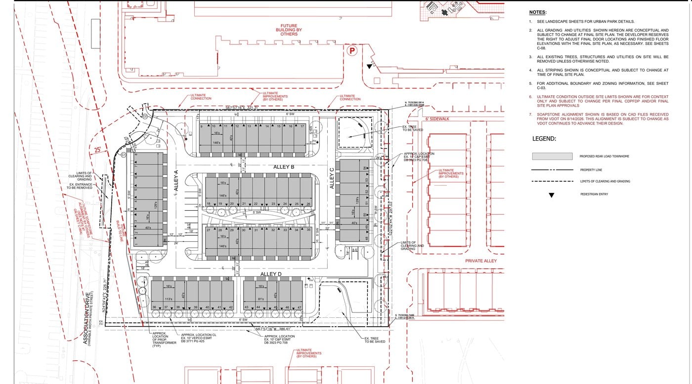
A builder is committing land to a road with no construction start closer than the early 2030s. It also explains the timing. Once VDOT starts buying right of way in 2027, the position of a 2.5-acre parcel sitting in the alignment gets complicated.
Trees, traffic and the rest of the file
Trees. The comprehensive plan names mature tree preservation as a major expectation for Association Drive redevelopment. Toll’s plan retains two notable specimens, one about 48 inches in diameter and another in the upper 20-inch range, and preserves roughly 2,643 square feet of existing canopy toward a 10 percent ten-year canopy requirement. New planting covers the rest. The filing concedes the project does not hit the separate tree preservation target through retention alone.
Traffic. FCDOT reviewed the proposal on August 27 and assigned it a Tier 1 Transportation Statement, the lightest of the county’s three study levels, under log number 26-055. Fifty-four townhouses replacing an office building do not generate the trip volume that triggers a full transportation analysis. The determination form also lists net CO2 emissions of 336 kilograms, without stating a time period.
Stormwater. Impervious surface across the 2.32-acre analysis area rises from 0.97 acre to 1.69 acres. The plan handles it with three urban bioretention tree pits, an underground detention vault holding about 4,500 cubic feet, and a proprietary treatment device. No surface pond.
Parking. Private garages, driveways, and shared visitor spaces, with the garages pushed to the rear alleys.
What has actually been happening on Association Drive
The associations that named this street have been leaving it for years. County zoning records from the past three years show interpretation requests and applications at 1912 and 1914 Association Drive for a pet resort, a garden academy, an adult health center, and a fencing club. Those are the tenants that fill 1970s office space when the original owners move on or downsize, and they usually show up in the last chapter before a redevelopment filing.
Meanwhile the housing has been arriving all around it. Wheelock Communities finished the first townhomes at Sunset Station on the old Fannie Mae campus this summer and filed in February to add up to 150 stacked townhomes on the rest of the site. The Board of Supervisors adopted a plan amendment for 1950 Roland Clarke Place on August 25, clearing the way for about 70 townhomes half a mile west, with the rezoning still to come. The Board approved Lofts II in July.
Toll Brothers has run this exact play here before. In 2017 the company tore down a six-story office building at 11720 Sunrise Valley Drive and built Valley and Park, 54 townhomes that opened in early 2019 priced in the mid $800,000s. Same builder, same unit count, same premise, one mile west.
What this means if you own or want to buy nearby
For buyers. Fifty-four new townhouses within a third of a mile of Wiehle-Reston East would be a meaningful addition to a submarket that mostly trades resale product built between the 1970s and the 1990s. Sixteen-foot-wide, four-story, rear-loaded units are the standard Northern Virginia transit-area product, and Toll builds for sale rather than for rent, though the filing itself does not use either word. Nothing sells here soon. A rezoning of this size typically runs a year to two years through staff review, the Reston Planning and Zoning Committee, the Hunter Mill land use process, the Planning Commission and the Board of Supervisors, with demolition and construction after that. Valley and Park is the useful benchmark for what these end up looking like and costing, adjusted for seven years of appreciation.
For owners in South Reston. Two forces pull in opposite directions. New construction within walking distance raises the price ceiling for the area, and it also gives buyers an alternative to a 1985 townhouse. Transit-area new construction usually prices well above nearby resale, and buyers who cannot reach the new product tend to land on the resale stock, which supports values rather than undercutting them. The bigger variable for anyone near Soapstone Drive is the connector itself, which will reroute a real share of local traffic whenever it opens.
For anyone tracking the whole street. Watch two dates. The first is whenever Fairfax County schedules hearings on SSPA 2023-III-16UP, which sets the ground rules for the other eight parcels. The second is 2027, when VDOT starts acquiring right of way for the connector. Those two together decide whether Association Drive redevelops as one coordinated neighborhood or as a run of one-off rezonings like this one.
Where the application goes next
The case sits in “submitted” status, which means county staff have it and have not yet accepted it for full review. From there it moves to staff analysis and agency comment, then to the Reston Planning and Zoning Committee and the Hunter Mill District land use process for community review, then to a Planning Commission public hearing, and finally to the Board of Supervisors. Anyone can read the full file, including the plan set, the statement of justification and the FCDOT determination, by searching RZ-2026-HM-00029 in the county’s PLUS portal.
We track every rezoning, site plan and permit filed in Reston and Herndon, and we write them up here as they land. If you own on or near Association Drive, or you are trying to work out what a Metro-adjacent townhouse will be worth in 2030, reach out. We are glad to walk through what the filings say and what they mean for your address.